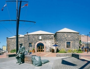
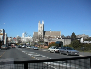
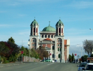
Timaru retains its historic heritage, both in terms of its architecture and through local treasures housed in the excellent South Canterbury Museum, close to central Timaru. The Aigantighe Art Gallery enjoys a well-deserved reputation as having one of the best collections of New Zealand art to be found in any provincial city.
Timaru is renowned for its rose gardens, in parks, private gardens and streetscapes, awash with colour throughout the summer season. The City even has its own rose - a vibrant red floribunda named "Trumpeter" after the famous musician Louis Armstrong and the Timaru Festival of Roses is held every November.
The origin of the name 'Timaru' is disputed, some believe that it derives from Maori Te Maru, which can mean a 'place of shelter'. Maori canoes seem to have employed the site of Timaru as a place to rest on long journeys up and down the eastern coastline for many years before the arrival of the first Europeans in the 19th century. The area includes over 500 sites with traces of Maori rock art, particularly in the rock overhangs and caves of the Opuha and Opihi river valleys, to the west of modern day Timaru.
Archaeologists have suggested that Maori tribes were permanently settled in the district before 1400 AD. During the 17th or 18th century the resident Ngati Mamoe were driven southwards into Fiordland by an invasion of the Ngai Tahu, who came from the North Island.
European settlement began with the construction of a whaling station in 1839 by the Weller brothers of Otago at Patiti Point, close to the present town centre. A supply ship, The Caroline, provided the name for the local bay. Later a sheep station, known as The Levels, was created on land purchased by the Rhodes brothers.
Few lived in Timaru until 1859 when the ship SS Strathallan arrived from England, carrying a party of 120 immigrants. Persistent land disputes arose between the brothers and local government officials with the result that two townships were established in the port area, Government Town and Rhodestown. These eventually merged into a single community in 1868.
Following the loss of a number of vessels off the coast, work started on the redevelopment of the artificial port in 1877, which eventually caused sand washed south down the Pacific shoreline to build up against the northern mole. This was the beginning of the extensive land reclamation around the Caroline Bay district, an area which is still growing today.
Timaru continued to expand during the 20th century, with much of the development taking the form of wooden colonial style bungalows set in individual sections of land.
Timaru has a dry temperate climate, temperatures are warm in summer and cold in winter. Rain is evenly distributed throughout the year, with a very small proportion of it falling as snow.
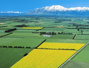
Timaru is an agricultural service town and port for the South Canterbury regional economy and is the second largest fishing port in New Zealand.
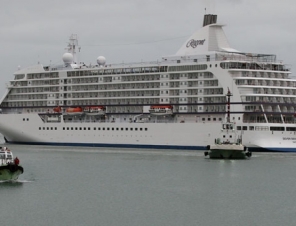
Can i walk into town from the ship?
Yes, its only about 500 metres to the town centre.

 |
|


